Abschlussarbeiten
---------------------------------------------------------------
aus dem Jahr 2022
---------------------------------------------------------------
Jean Marie Mukosolu Chukwuma | Juni 2022
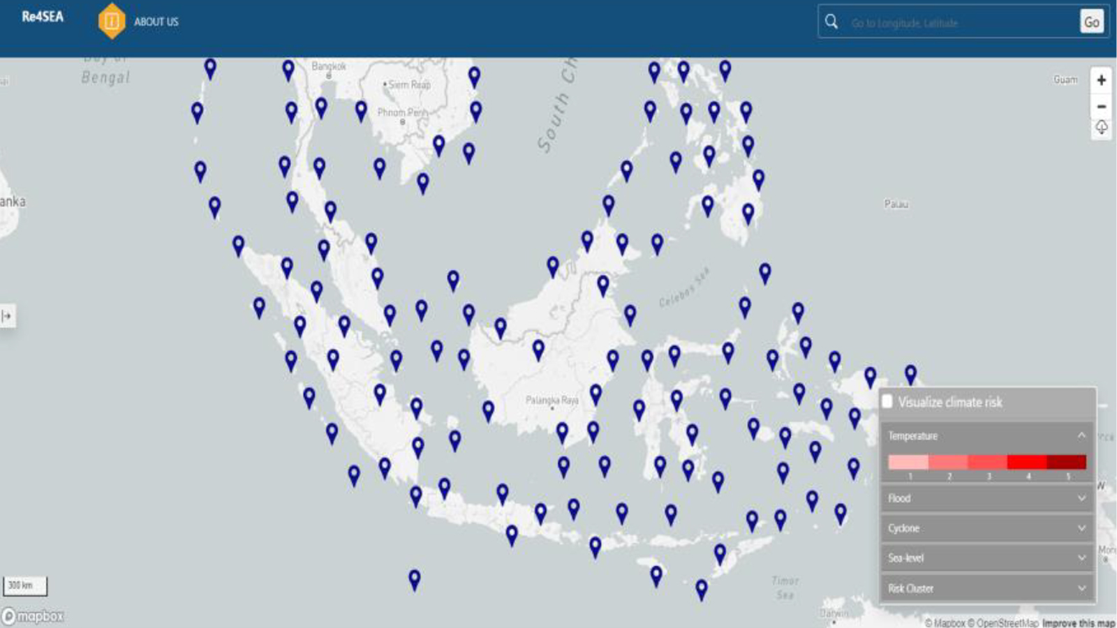
Conception And Software Developments On A Data Re trieval, Visualization And Time Series Analysis Plat form To Support Climate Change Resilient Energy System Planning On Southeast Asian IslandsS (236 kb)
Ali Hmeedan | Mai 2022
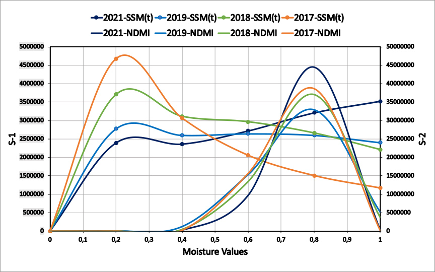
The Danube Delta Estimation of Relative Soil Moisture Content Using Sentinel-1 & Sentinel-2 Satellite Data (546 kb)
---------------------------------------------------------------
aus dem Jahr 2021
---------------------------------------------------------------
Melanie Riester | Mai 2021
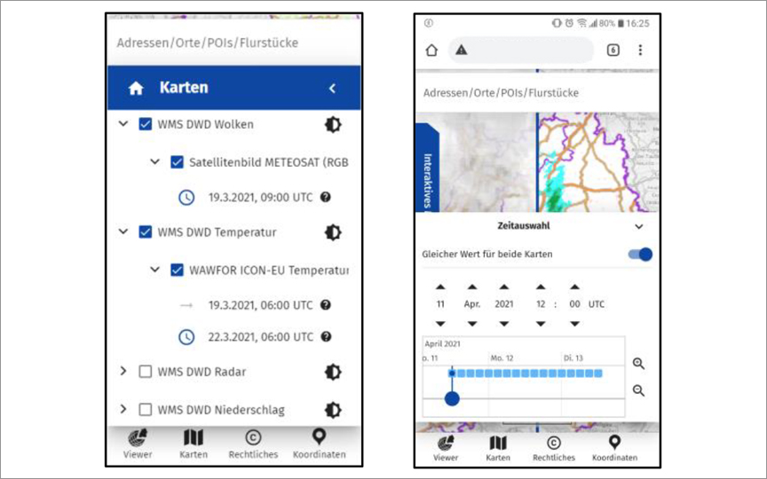
Investigation of Dynamic Visualization of WMS with Additional Dimensions in a WebGIS (95 kb)
Chinazom Eunice Nnoli | January 2021
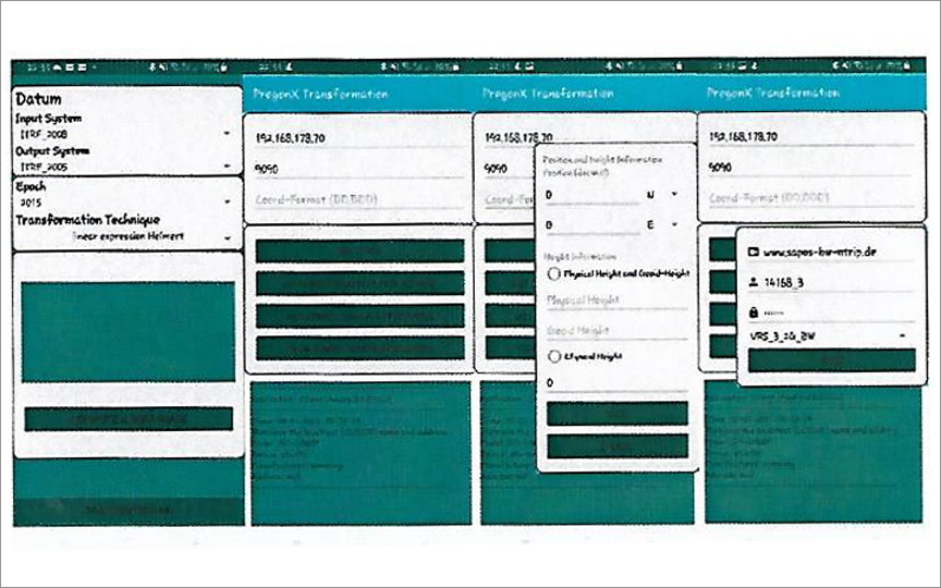
Mathematical Model, Software Design, Implementation and Validation of a General Plate and RTCM Transformation Con cept for Mobile GIS Applications with Android Smartphones (303 kb)
Philipp Juhasz | January 2021
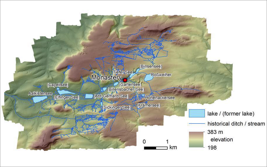
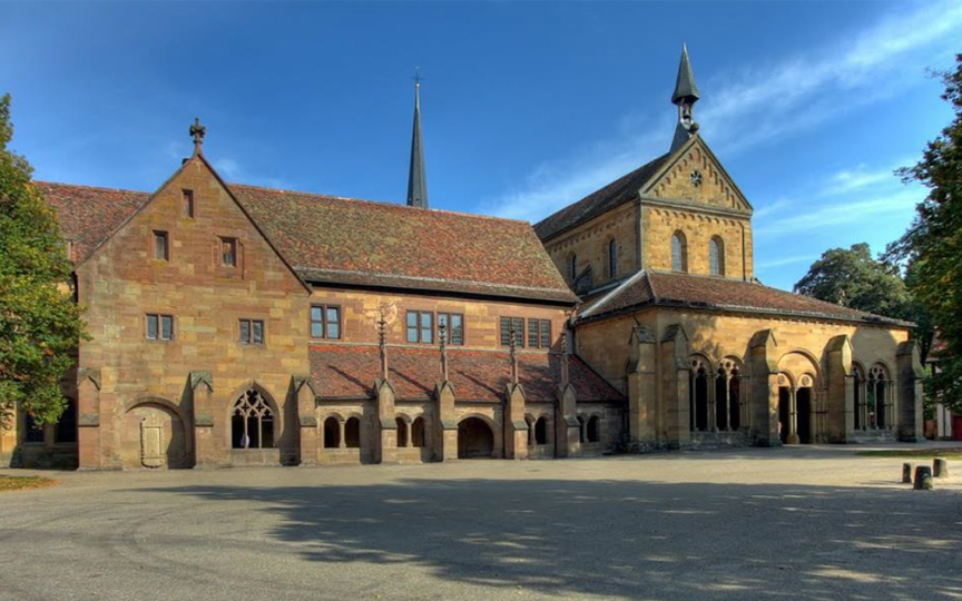
Potential of different remote sensing techniques for detecting ditches of the Maulbronn Monastery water management system (940 kb)
---------------------------------------------------------------
aus dem Jahr 2020
---------------------------------------------------------------
Nina Kirschner | Oktober 2020
Spatio-Temporal Prediction of Point-Referenced Environmental Data (517 kb)
Lukas Nübel | Mai 2020
Conceptualization and prototyping of an algorithm for providing geodata using the concept of vector tiling (183 kb)
---------------------------------------------------------------
aus dem Jahr 2019
---------------------------------------------------------------
Jesús Nicolás Sánchez Martínez | December 2019
Development of a data platform for the Cultural Heritage Project Maulbronn Monastery (736 kb)
Yair Preiss | December 2019
Evaluation of Different Storage Formats for Geospatial Data Caches Including a Sample Implementation to Enable ArcGIS Portal to Export Caches (584 kb)
Jorge Hernández Olcina | December 2019
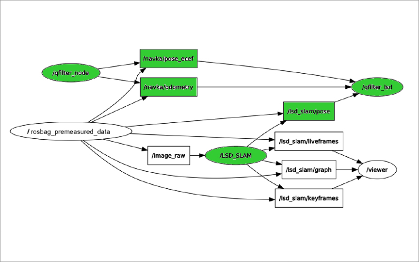
Implementation of Moving-Base-GNSS in NAVKA Multisensor GNSS/MEMS/Optics Navigation Algorithms and Systems (439 kb)
Raquel Arcón Navarro | December 2019
Capturing improved TLS data of Maulbronn Monastery and integration of the mesh into the existing UNITY visualization (699 kb)
Raquel Luján | December 2019
mplementation of PPP as new GNSS Observation Type in the Geomonitoring System GOCA (531 kb)
Saeid Ghalichehbaf | December 2019
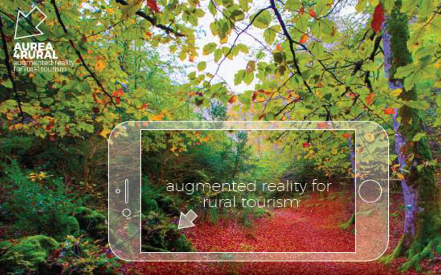
Novel Digital Tool and Embedded Learning Approach for the Use of Augmented Reality in Rural Tourism and Related Sectors (296 kb)
Sylvester Tabi Kyei Amponsah | November 2019
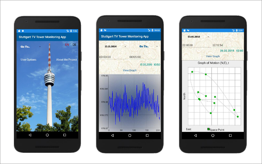
Theoretical Studies and App Development on Algorithms & Visualization on Geodetic and Structural Health Monitoring (SHM) at the Reference Object Television Tower Stuttgart (864 kb)
Musa Fadul | November 2019
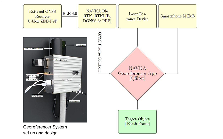
Evaluation and Further Development of The NAVKA Smartphone Laser Georeferencer (979 kb)
Carina Bühler | November 2019
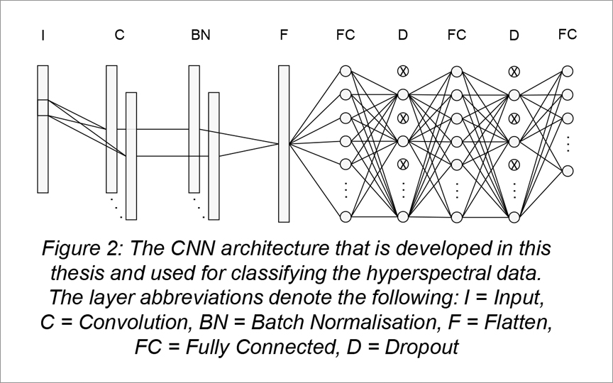
Fundamental research on convolutional neural network architectures for extracting spectral features from hyperspectral data – An approach of adapting pre-trained models (206 kb)
Carlos Bayarri Cebrecos | November 2019
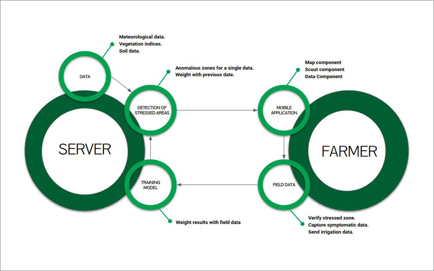
Development of a mobile-supported crop management and stress analysis system based on remote sensing products and symptomatic data
Marzena Wicht | October 2019
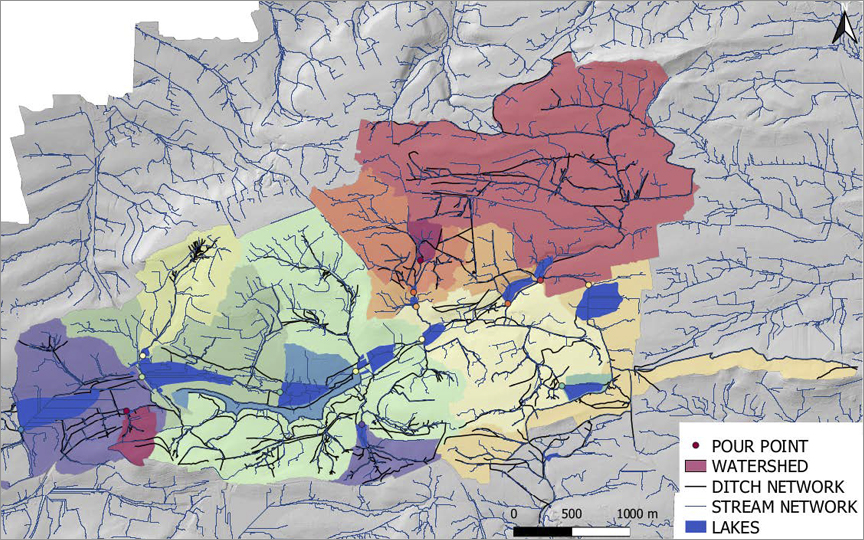
Multisource data fusion for historic DEM creation to facilitate hydrological analysis of historical Maulbronn Monastery complex water system (592 kb)
Agageldi Samedov | September 2019
Development of remote sensing solutions for locust damage detection in Kazakhstan as part of the project Locust-Tec (310 kb)
Eltaieb Albasheer | Juli 2019
Algorithms, Systems and Software Development for an Image and GNSS/MEMS-based Navigation and Object-referencing (303 kb)