Research projects related to the geomatics
study programmes
Freiraum-project Open Geo-Data-Science Space | April 2024
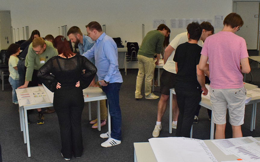
The aim of the project funded by the Foundation for Innovation in Higher Education (STiL) is to develop a Bachelors’ degree program being a) innovative in its approach by bringing students on board as stakeholders in the design process, and being b) attractive, state-wide unique and up-to-date in terms of its thematic focus. Here it seems promising to combine data science, geo(infor)matics and sustainability. The project activities are attended to in a scientific ways, i.e. the methods used and the results are reflected upon in each case, also in order to link them with the results from an empirical, Germany-wide survey.
Project lead: Prof. Dr. Gertrud Schaab (IMM), Prof. Dr. Christine Preisach (IWI) and Prof. Dr. Michael Tewes (IMM)
to project website
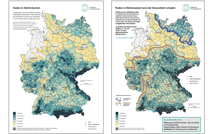
BfS-maps – their effects on risk perception and risk understanding | May 2023
On behalf of the German Federal Office for Radiation Protection, the research project examines how successfully its information channels contribute to risk communication, i.e. not only informing people, but also motivating them to take preventive and protective action, this based on the two radiation protection topics of UV radiation and radon. Since the static and interactive maps of the BfS, which visualize their exposures geographically for Germany, are here a prominent means, it is the task of Karlsruhe University of Applied Sciences to support the project with cartographic expertise.
Project lead: Dr. Annette Cerulli-Harms (ConPolicy)
Pcollaboration among others: Prof. Dr. Gertrud Schaab
zum final report
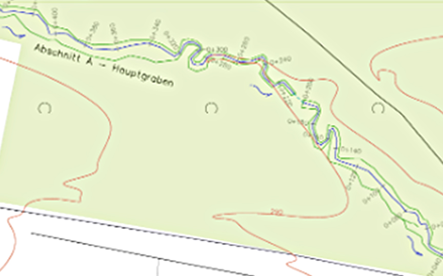
Digital reconstruction of the historical water management system | May 2022
Maulbronn Monastery
The monastic water management system has also been under UNESCO protection since 1993. By means of topographical surveys, evaluation of aerial photographs and historical documents, this water management system is recorded, modelled and presented on the Internet. This system was a prerequisite for the Cistercian monks for a variety of tasks, such as fish farming, fresh water supply, drainage, etc.
Project collaborators: Prof. Dr. Heinz Saler / Dipl.-Ing (FH) Chr. Stern
Project participants: Landesamt für Denkmalpflege BW
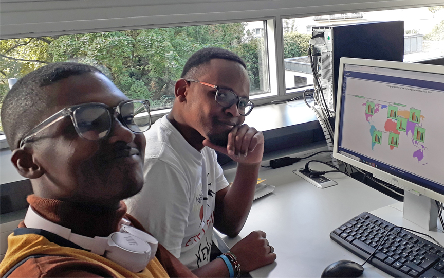
BWS plus project Cognitive Geomatics | April 2022
The mere positioning of objects based on geographic coordinates does not do justice to the subjective experiences of space and the world around us (space versus place). Spatial perception and awareness of space or "sense of place" also differ from one culture to another. This raises questions about the nature of the interplay between the way we think about and perceive physical space (our mental maps) and the use of high-tech methods for measuring, analyzing and visualizing our environment (in the virtual world). In the BWS plus project, we are exploring this question by developing blended learning tools that will be employed at the participating universities in Pretoria, Nairobi and Karlsruhe.
Project lead: Prof. Dr. Gertrud Schaab (Hochschule Karlsruhe), Prof. Serena Coetzee / Prof. Nerhene Davis (University of Pretoria) and Prof. Dr. Faith Karanja (University of Nairobi)
to project website
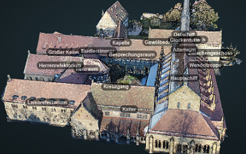
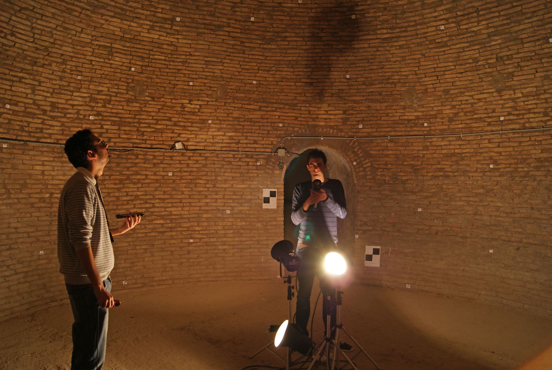
Online visualisation of Maulbronn Monastery | April 2022
The Maulbronn Monastery World Heritage Site is to be visually presented to the public, with particular attention being paid to non-public areas. Laser scanning data, drone images and CAD constructions form the data basis for the realistic visualisation using various 3D publishing techniques such as game engines.
Project collaborators: Prof. Dr. Heinz Saler and Dipl.-Ing (FH) K. Berner
Video: Youtube / Point cloud: Fakulty IMM
Press: DVW and Der Kurier
Funding: Landesstiftung Baden-Württemberg
and DFG ("Sacred Sound - Sacred Space")
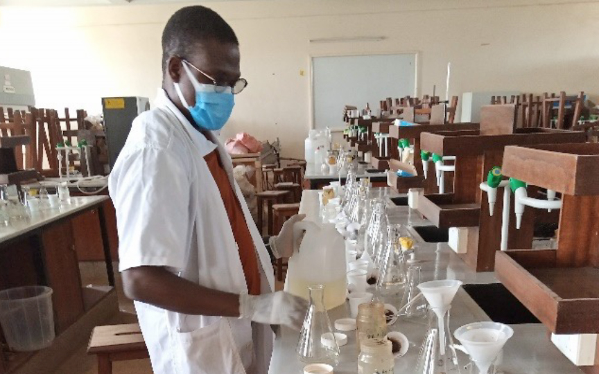
PhD on peri-urban agrisystems dynamics and vegetable farming | March 2022
Arcadius Ahogle also came to Karlsruhe University of Applied Sciences for six months in 2022, as part of his DAAD scholarship for writing a PhD dissertation at Kenyatta University in Kenya, in order to get supervision on using remote sensing and GIS to spatially integrate and scale his results on vegetable farming in the south-eastern fringe of Nairobi. His work includes not only studies on the contamination of vegetables, soil and irrigation water, the survey of farmers for a farming typology, the land use changes experienced in the study area, but also the integration of the multidisciplinary data via GIS for an assessment of vegetable farming in the context of food and nutrition security in rapidly expanding peri-urban settlements.
Supervisors: Prof. Dr. Gertrud Schaab (Hochschule Karlsruhe), Prof. Dr. Sammy Letema, Dr. Nicholas K. Korir (Kenyatta University)
to news re PhD defence
PhD on land use/cover and livelihood scenarios as part of WoPedyP | February 2022
Here, PhD student Deepthi Patric examines in particular the peri-urban area in the study area of Mankweng and surroundings through object-based image analysis of very-high-resolution WorldView-3 satellite imagery. The fine granularity and high diversity of classes subsequently enable the differentiation of areas according to their degree of urbanization and associated livelihoods, whereby results of the project partners on livelihood characteristics are also included in a typology. Finally, scenarios of possible futures in combination with transformation pathways shall help in making the knowledge gathered in the project also relevant for planning.
Supervisors: Prof. Dr. Gertrud Schaab (Hochschule Karlsruhe), Prof. Dr. Martin Kappas, Dr. Daniel Wyss (Universität Göttingen)
to project website
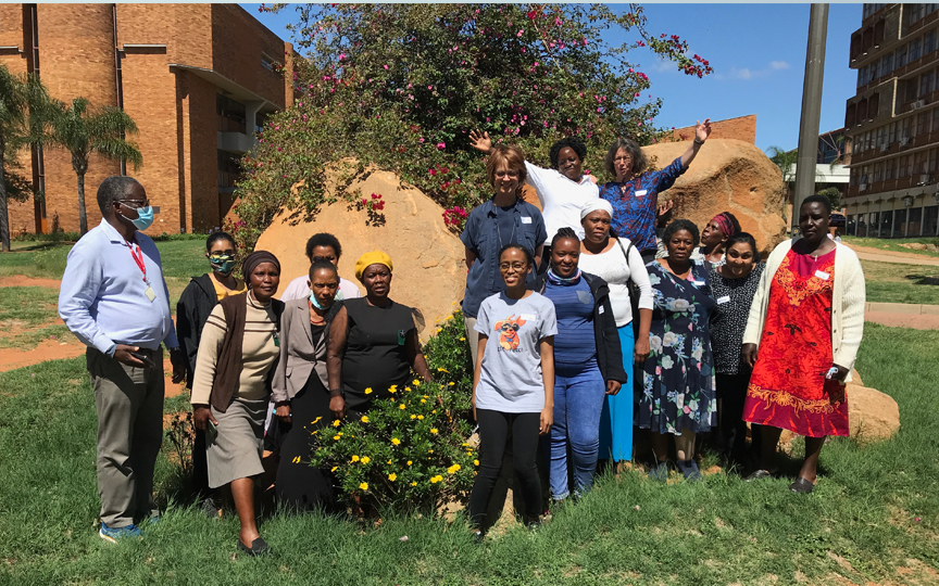
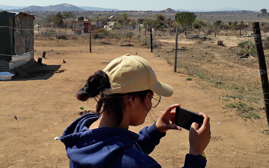
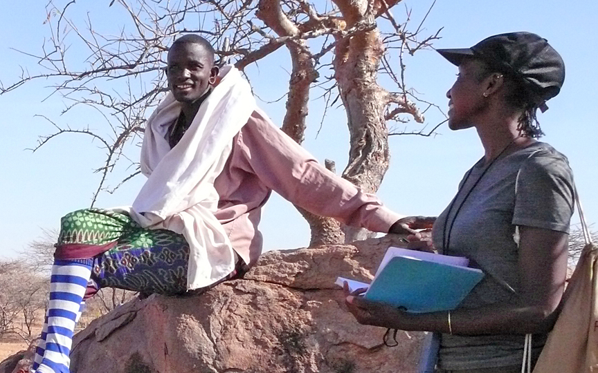
WoPedyP project on Women’s Perceptions and Place Dynamics | November 2021
Our overarching research question in the BMBF and NRF-funded joint project with partners at the University of Pretoria, the University of Limpopo and the NGO We can Women is how women's perceptions of place dynamics can contribute to promoting women's agency with regard to an active place-making in peri-urban settlements. Based on the co-production of knowledge, transformation pathways are derived for maintaining peri-urban livelihoods in Mankweng (Limpopo Province, South Africa); these are finally illustrated by spatially-explicit scenarios.
Project lead: Prof. Dr. Gertrud Schaab (Hochschule Karlsruhe) and Prof. Dr. Serena Coetzee / Prof. Dr. Nerhene Davis (University of Pretoria)
to project website
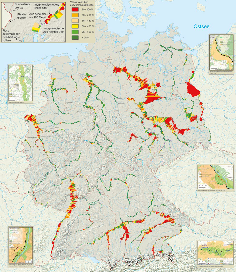
Floodplain status report 2021 shows urgent need for action | March 2021
The Geoinformation Management degree programme at Karlsruhe University of Applied Sciences is providing the scientific database for the Federal Environment Ministry's Floodplain Status Report 2021 via the three-year research project ‘River floodplain balancing and assessment 2.0’ (commissioned by the Federal Agency for Nature Conservation, BfN).
Project management: Prof. Dr. Detlef Günther-Diringer
Cooperation: Ing.-Büro Koenzen (Hilden)
Press release by HKA on the floodplain status 2021
Press release BMU_BfN
StoryMap with extensive geodata from the floodplain status report 2021
Cooperative PhD on cheetahs in Kenya | September 2020
Noreen Mutoro wished for a doctorate on the basis of data on cheetahs in Kenya, as collected over many years by the NGO “Action for Cheetahs in Kenya”. As part of a cooperative PhD work based at the University of Salzburg, Noreen is supervised by Karlsruhe University of Applied Sciences on the use of spatial data and spatial modeling of habitats to infer cheetah distribution maps. Here, the doctoral student is interested in how large infrastructure projects impact the distribution of cheetahs outside protected areas.
Supervisors: Prof. Dr. Gertrud Schaab (Hochschule Karlsruhe), Prof. Dr. Jan Habel (Universität Salzburg)
to news re PhD defence
Paper
Geomatics for the preservation of cultural heritage | December 2019
In Prof. Dr. Saler's project, students from the faculty have the opportunity to document, analyse and visualise cultural assets on the Internet together with Spanish and Greek students as part of field placements in Spain (Bujasot), Greece (Vergina) and Germany (Maulbronn).
Project management: Prof. Dr. Heinz Saler
Funding: Landesstiftung Baden-Württemberg
Project description: "Silos-de-Burjassot"
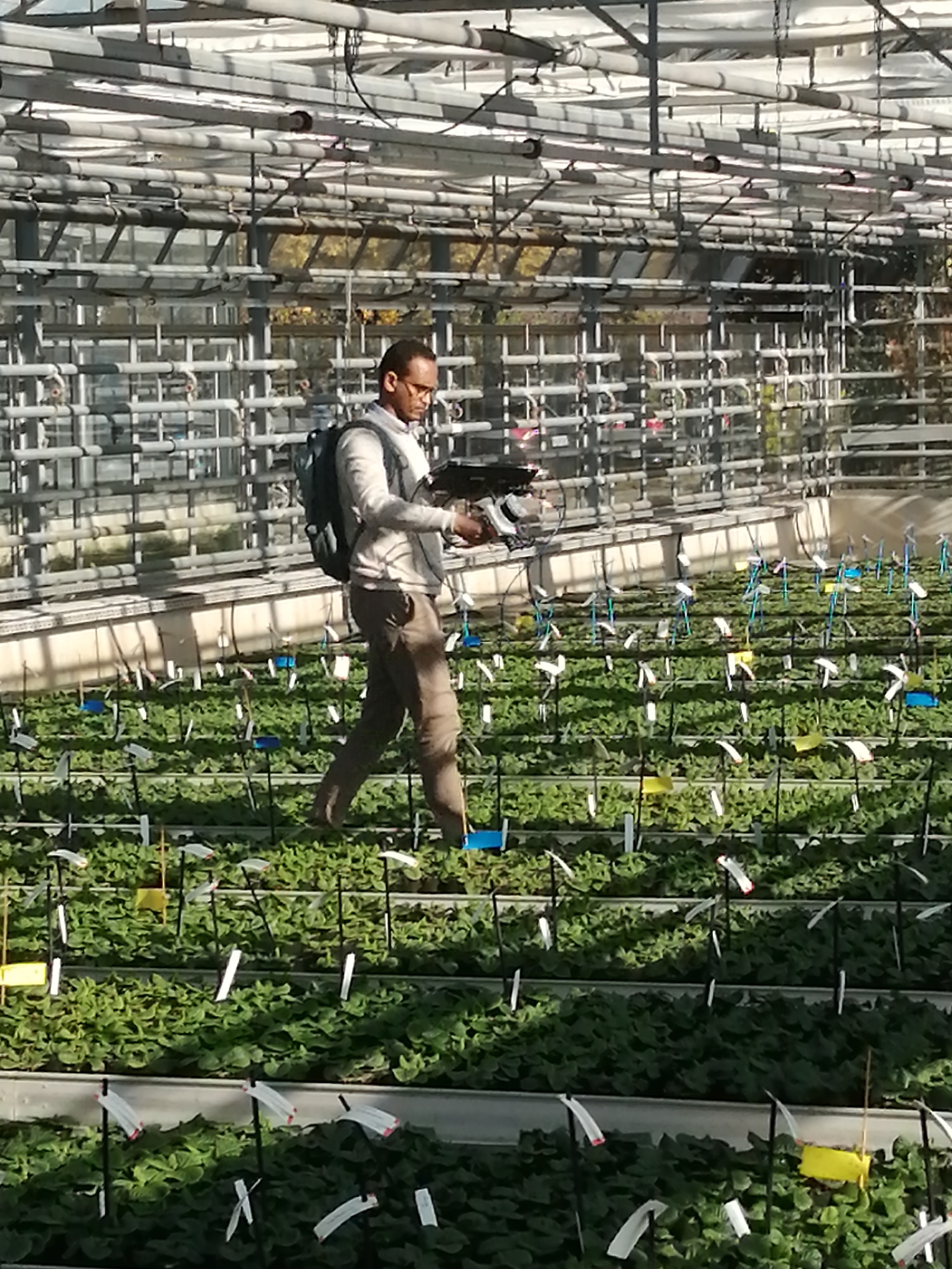
NAVKA project MiteSens
The aim of the three-year joint project in the field of Digital Agriculture 4.0, funded by the Federal Ministry of Agriculture and Food, is research and development (R&D) under the title MiteSens and with seven consortium partners for a UAV-based monitoring system for the early detection of plant pests of the spider mite type (‘mites’) in greenhouses.
Project management: Prof. Dr. Reiner Jäger
to the project page
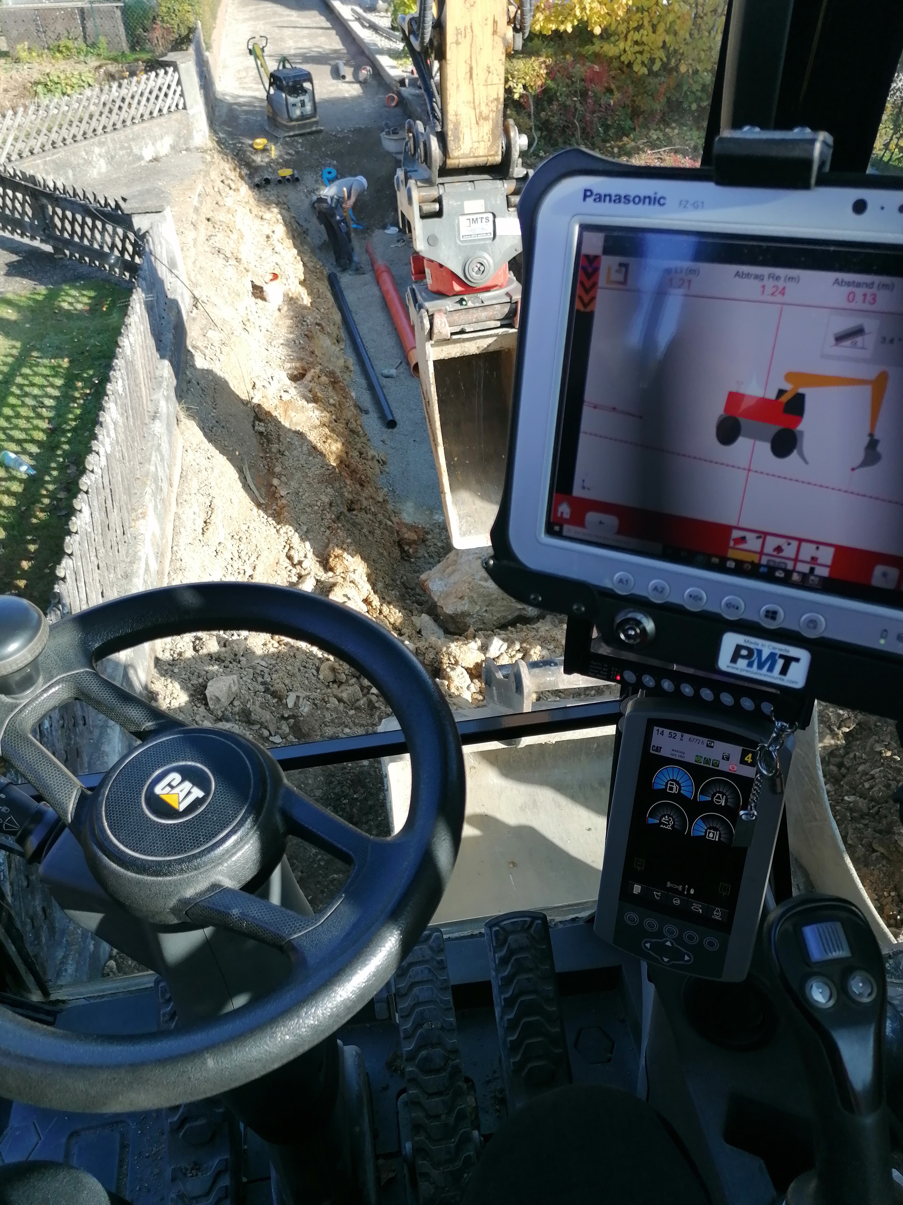
NAVKA project HOBA
The research and development (R&D) in the HOBA project (Homogeneous Area Assistant for the automatic, construction site-specific recording of soil classes according to the new VOB 2016) is concerned with R&D for the automatic classification, segmentation and georeferencing of a 3D voxel volume model of soil types according to the new VOB 2016.
Project management: Prof. Dr. Reiner Jäger
to the project page
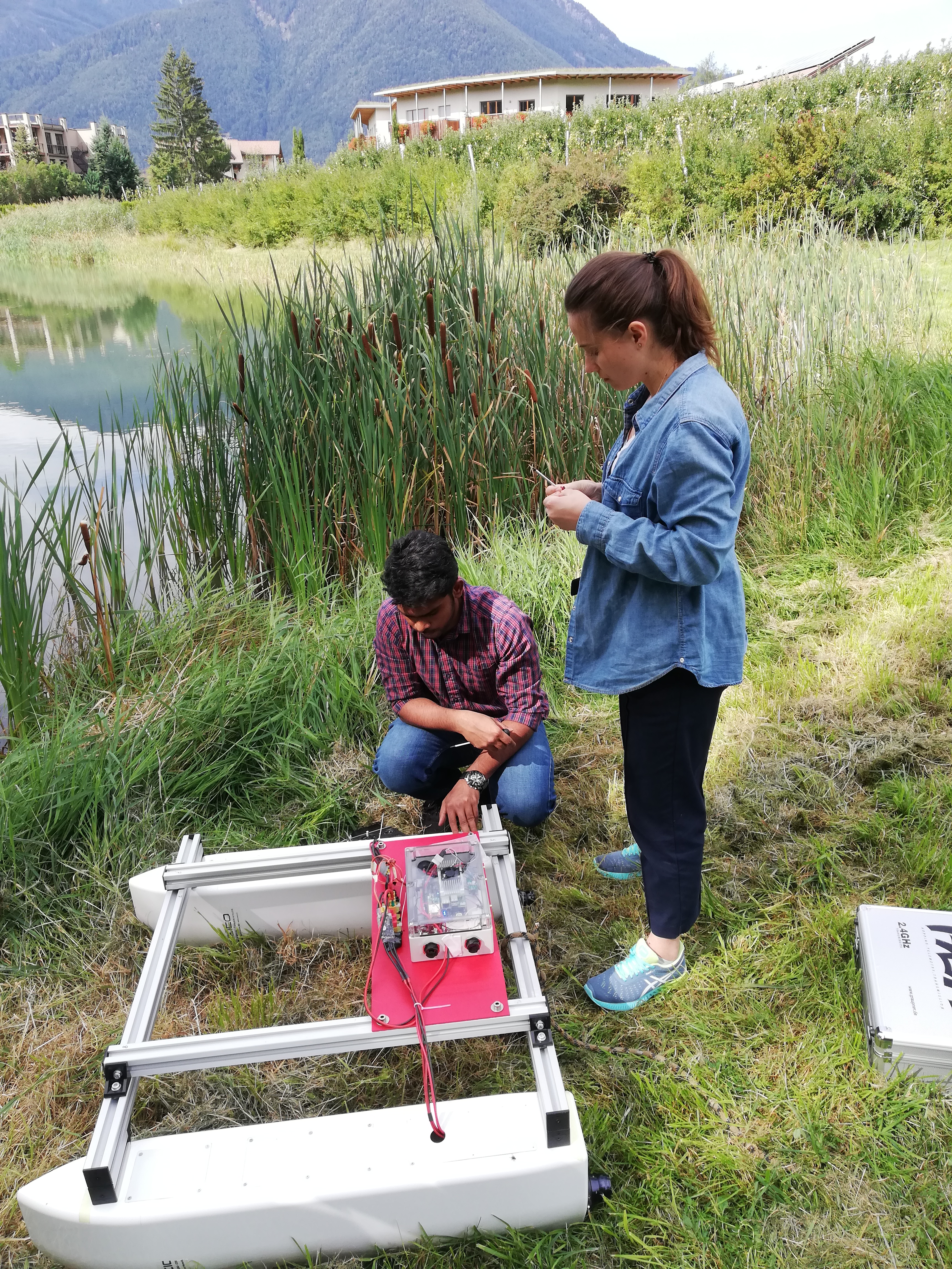
Autonomous driving and water robots
The Harby R&D project is aimed at the complete system development of an autonomous water robot that is scalable in size and application.
Project management: Prof. Dr. Reiner Jäger
to the project page
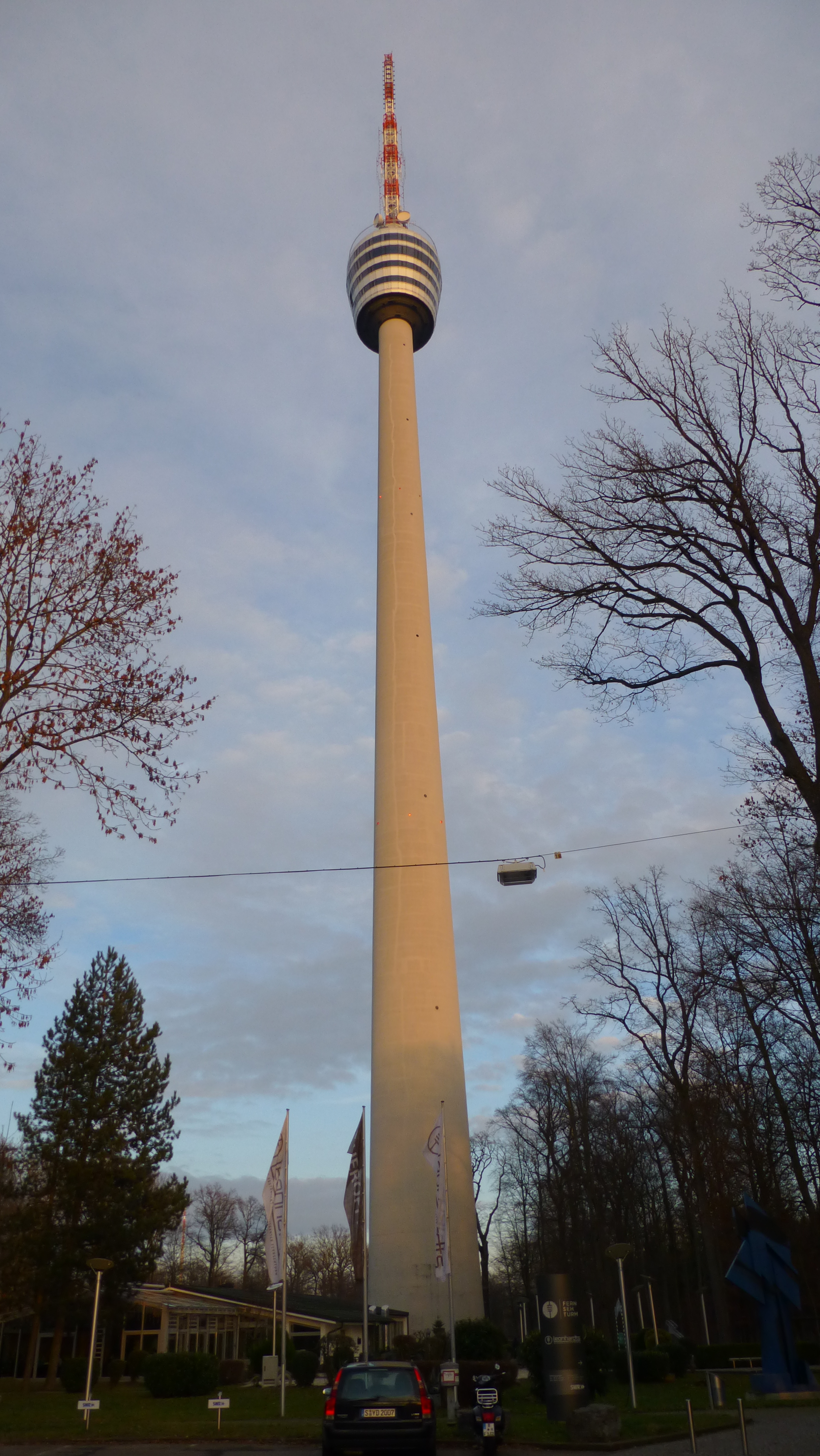
Stuttgart Television Tower Structural Health Monitoring
The Stuttgart television tower as a reference object for research, development and testing of innovative sensor systems, mathematical models, algorithms, software and IT for the early detection of damage and potential hazards in structural systems.
Project management: Prof. Dr. Reiner Jäger
to the project page
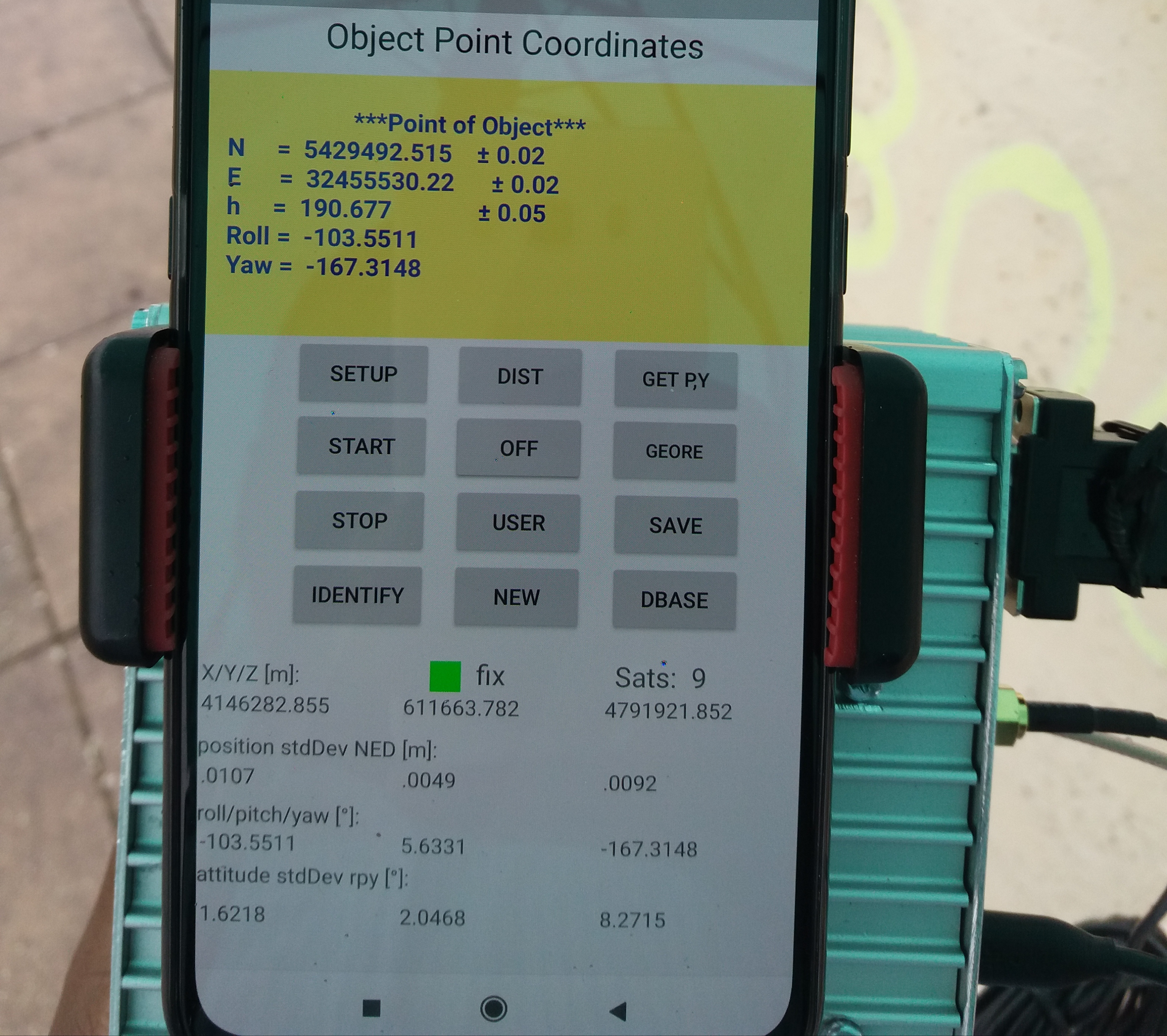
GNSS Raw Data on Smartphones ESA Task Force
The research and developments at the HSKA within the NAVKA project deal with cycleslips- and ambiguity-robust GNSS algorithms and software developments (DGNSS, PPP) using GNSS raw data.
Project management: Prof. Dr. Reiner Jäger
to the project page