
Environmental and Geo-Information Management
Overview
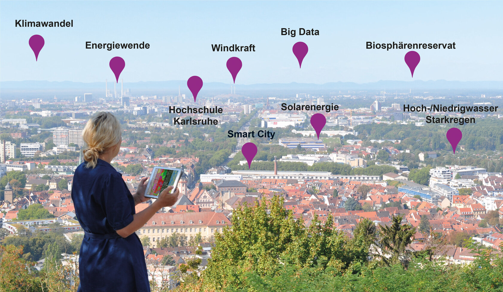
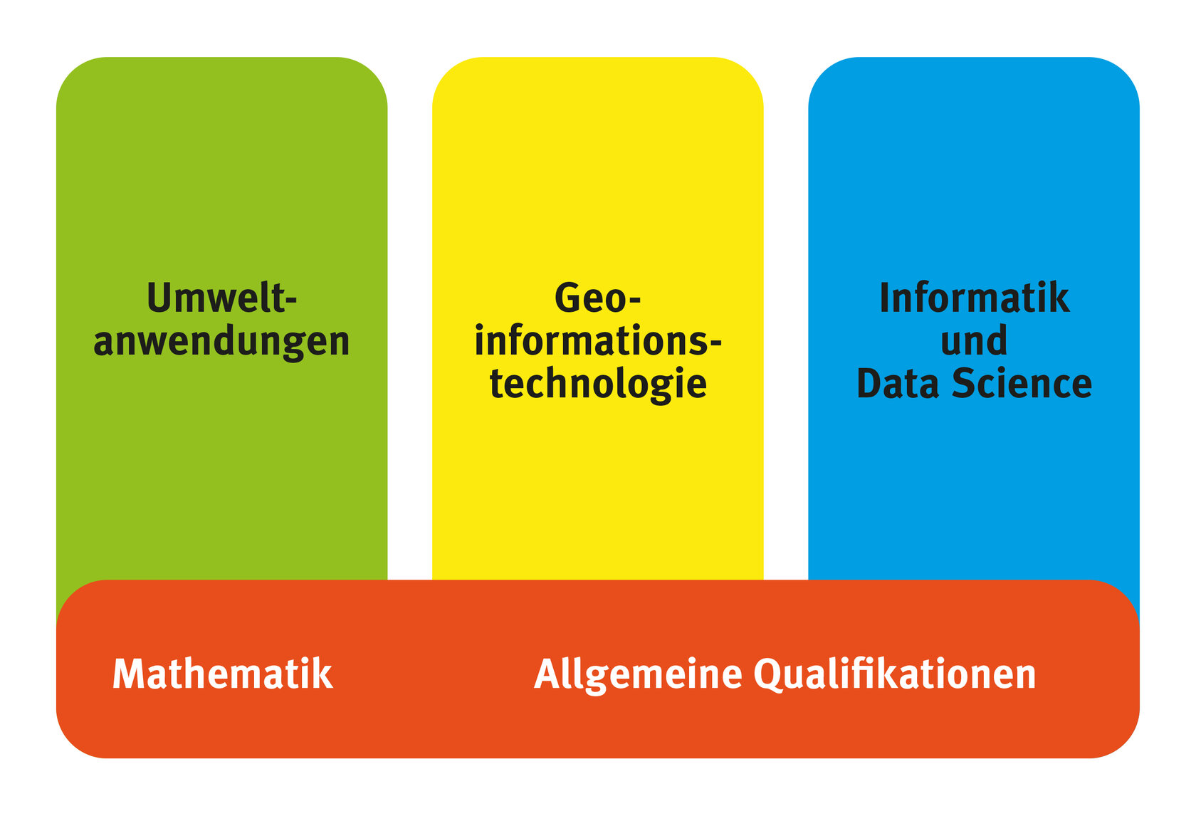
We apply cutting-edge computer technologies to address important environmental issues. The latest sensors in space provide valuable Big Earth Data, which are analyzed with up-to-date software and can be used in conjunction with diverse geodata for environmental modeling: Where are the best wind power sites, How does electricity get from northern to southern Germany, What is the impact of the next heavy rain event, How does climate change affect land use, and much more. The program is built along three thematic lines: Environmental Applications, Geospatial Information Technology, and Computer Science and Data Science.
At a glance
| Admission prerequisites | Pre-study work experience is not required |
Who is the program aimed at?
If you are interested in landscape-related environmental issues and enjoy working with computer technologies, you are in the right place. After graduation, there is the possibility to be employed in environment-related administration, engineering offices or in the field of science to actively contribute to the solution of environmental issues. There is also the possibility of joining the 3-semester international master's program in Geomatics at Karlsruhe University of Applied Sciences.

A student reports...
Why did you decide to study this degree program?
Nina Dorffer: I wanted to study a technology subject that is application-oriented and deals with the environment. Also, maps have always fascinated me. The program perfectly fit these requirements.
For which reasons would you recommend this degree program to other students?
Nina Dorffer: I think that the combination of environmental management and geoinformation management is very interesting. Even in everyday life, you always encounter issues with spatial relevance that present interesting use cases. For example: How do environmental protection measures affect air quality? In what way does a flood change the landscape?
One advantage of this program is that theoretical knowledge is deepened by means of project work. For example, satellite data is processed to analyze the condition and changes of the earth's surface. This makes it possible, for example, to observe the diminishing of glaciers. The computer science part helps to visualize the data with spatial reference in web applications, to program own apps and to process the spatial data automatically. A lot of work is done with geoinformation systems, with the help of which geodata can be easily visualized. But it can also be used to perform exciting analyses, such as finding the right location for a cocoa plantation.
Another advantage of this degree program is that you are well prepared, due to the practical knowledge, for the job market. Since expertise is sought after in this field, you can work as a student trainee in a wide variety of companies while you are still studying.
Why did you decide to study at Karlsruhe University of Applied Sciences?
Nina Dorffer: There are many similar degree programs at other universities and universities of applied sciences. However, in these programs, computer science often plays a smaller and geodesy a bigger part. The studies at Karlsruhe University of Applied Sciences focus on analysis and its presentation, which means that the computer science part is higher, especially in the area of web programming, which interested me more.
Another advantage of the study program at Karlsruhe University of Applied Sciences is the small size of the study program and of the faculty. You work a lot with your fellow students and have a lot of contact with the professors, who take time for the students and support you during your studies.
What do you want to achieve for your career entry or your later professional life?
Nina Dorffer: There are many different professions that you can aim for after graduating. The application-oriented nature of the program and also the internship semester in the fifth semester help to guide you. I completed my internship semester at a software company. As an environmental and geoinformation manager, you often work at the interface between the software developers and the customers. In concrete terms, this means that you implement solutions for customers and advise them. This means that you are in contact with the customer and the application area, which I find good. I would also like to work in this area after finishing my studies.
Offers for interested parties
Extensive web GIS applications are available on the geoportal of Karlsruhe University of Applied Sciences, e.g:
- Floodplain balancing 2.1: 10,000 river k of German floodplains up to a scale of 1:10,000
- Maulbronn Monastery: student work on the historical water system of the monastery
- Ground Truthing in Samburu: Story Map of Samburu field trip - a Story of Colours
- Settlement development in Vel'ké Pole and Píla, Slovakia
- WebGIS Lower Danube: the floodplains from the Iron Gate to the Danube Delta
- Polder Bellenkopf / Rappenwörth
