Hochschule Karlsruhe Hochschule Karlsruhe - University of Applied Sciences
young engineers working at PCs

Environmental and Geo-Information Management

Profile Content Internship & studying abroad Career prospects

Career prospects

Due to the wide-ranging curriculum, graduates of the Environmental and Geo-Information Management program have a variety of career options open to them. With the increase in Big Geodata, there is a growing need for experts who can collect, process, analyze and visualize data in various media in ever shorter periods of time. Graduates are drawn in equal numbers to the public sector (federal, state, regional or local authorities for geo-information or environmental protection, universities and research institutions) and to the private sector (engineering firms, publishing houses, service providers or companies for geomarketing, transport planning, energy supply, etc.).

About half of the graduates go on to complete a master's degree, either the international Geomatics master's degree at Karlsruhe University of Applied Sciences or a master's degree at another university or university of applied sciences.

Examples

DIS employees standing on a spiral stair

Disy Informationssysteme GmbH

20 years of experience and market leader for spatial data management and data analysis in Germany.

Sebastian Lemstra (B.Sc./M.Sc.), Akila Sriramulu (B.Sc. College of Engineering, Guindy, Indien/M.Sc. Hochschule Karlsruhe), Roman Wössner (B.Sc. HfT Stuttgart/M.Sc. Hochschule Karlsruhe), Nicola König (B.Sc. Hochschule Karlsruhe/M.Sc. HtW Dresden), Anja Fürst (B.Sc./M.Sc.), Nina Kirschner (B.Sc./M.Sc. cand. Hochschule Karlsruhe), Jonas Hurst (Praxissemster Hochschule Karlsruhe), Moritz Geiger (B.Sc. Hochschule Karlsruhe /M.Sc. HafenCity Universität Hamburg), Roman Miller (B.Sc.) (from top left to bottom).
Employees of Disy Informationssysteme GmbH

photo of Mr Schwarz and Mr Oßwald

Altus AG

The "what and how" combined with the "where" are the key questions that need to be answered when planning wind farms. The professional analysis of geodata allows us to estimate the economic efficiency and the benefit of individual plants at an early stage and to advance targeted projects. In doing so, we work on behalf of municipalities, utilities and private companies.

Florian Schwarz (B.Sc. Hochschule Karlsruhe/M.Eng. Hochschule Anhalt) and Michael Oßwald (B.Sc.)
Team leader and project engineer at Altus AG

on the interactive Smart Table, the team looks at the SmartCity simulation platform they developed

EIfER

EIfER: European Institute For Energy Research, a joint venture of EDF France and KIT. An interdisciplinary team of more than 100 scientists from 17 countries is dedicated to basic research as well as to testing and implementing innovative technologies or methods. Research projects yield the answer to questions of energy efficiency in cities and regions and develop local energy concepts based on renewable energies.

On the interactive Smart Table, the team looks at the SmartCity simulation platform they developed. Counterclockwise from left to right: Dr. Jochen Wendel (Dipl.-Ing. (FH), MSc, PhD University of Colorado), Alexander Simons (BSc, MSc), Alexander Nichersu (BSc University of Bucarest, MSc) and team leader for Smart Cities Dr. Alberto Pasanisi.

ISB AG employees standing in the lobby in front of company logo

ISB AG

ISB AG stands for the integration of Geographic Information Systems (GIS) know-how and concrete technology into complex software applications and architectures.

Based on open source tools and commercial GIS products, we develop complex specialized procedures, WebGIS portals and spatial data infrastructures (GDI) for public administration. Our employees are (geo)computer scientists, natural scientists and cartographers.

Florian Lapolla (B.Sc.), Kent Wilde (B.Sc. Hochschule Karlsruhe /M.Sc. HafenCity Universität Hamburg), Matthias Beier (B.Sc./M.Sc.), Markus Enke (B.Sc. Hochschule Karlsruhe /M.Sc. Universität Heidelberg), Guido Lohaus (Dipl.-Ing. FH), Tobias Merz (B.Sc.) (from right to left)
Employees at ISB AG

Future fields in environmental and geo-information management

BIG GEODATA

Spatial analysis of mass data e.g. from social media. 
Sources: © Miguel Ríos-Berríos (www.flickr.com/photos/twitteroffice/sets/72157633647745984/with/8798022019/ - left) and © Stikky Media inc. (www.stikkymedia.com/blog/mapping-the-world-with-twitter-and-flickr/ - right)

WEBMAPPING

interactive and dynamic, if necessary as real-time visualization
Screenshot: BIOTA-E02 (www.iaf.hs-karlsruhe.de/gvisr/projects/tools/vis_tool/text/title.htm - left), Fremdsein 4.0 - Foto: Christian Seitz (www.iaf.hs-karlsruhe.de/gvisr/project/fremdsein40.html - right)

Environmental modeling

GIS-based applications e.g. on climate change, energy transition, flooding.

Illustration: Detlef Günther-Diringer (left), screenshot: Venessa Schakschewksi (right)

VR/AR-3D applications

with spatial reference
Photo by: Tobias Schwert (left), illustration: Matthias Beier (right)

Satellite image evaluations

of landscape changes, based e.g. on EU Sentinel program 

Illustrations: BIOTA-E02 (left) and The BIOTA East Africa Atlas (right)

Mobile map apps

for monitoring or participatory applications

Photos by: ACK (left) and Jan Jedersberger (right), screenshots: Jan Jedersberger

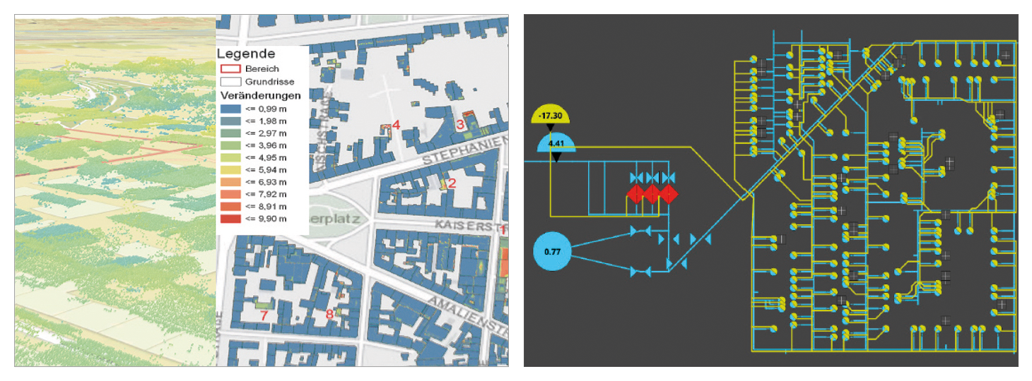
Smart city applications

Evaluation of various geo-sensors via common spatial interface

Screenshots: Maximilian Schröder (left) and Isaac Boates (right)

Downloads

Related links

Research projects from the geo-courses (dt.)

Master's degree program Geomatics

YouTube: Big Earth Data (dt.)

Organization & exams