Colmation – clogging of gravelly river beds
Clogging of watercourses refers to what is known as colmation. Put simply, this means that there is not enough space between the stones at the bottom of the river. Among other things, the deposition of fine particles prevents exchange with the groundwater, fish cannot find good conditions for laying eggs or their young cannot protect themselves in the impenetrable bed.
With her bachelor thesis, Ida Nitsche has contributed to the creation of reference values for the assessment of river conditions, as there are currently no quantifiable measurement parameters for recording colmation. We spoke to her about her bachelor's thesis entitled "Influence of catchment characteristics on the scouring of river beds".
HKA: How did you come up with this topic?
Ida Nitsche (IN): The Bachelor's degree in Environmental Civil Engineering Construction is quite broad and I had a few lectures with Professor Noack, who also supervised my information work. He told us a lot about the impact of human activity on bodies of water, which I found quite exciting. I think it was because I hadn't previously realized to what extent the vast majority of bodies of water – the Rhine, for example – are still not very natural today and how many intensive changes are being made to them. Sediments have to be transported back and forth all the time because otherwise navigation would no longer work.
And then what I found particularly exciting about my Bachelor's thesis was that I was able to take measurements myself, work with other people and be part of a larger project.
Was there a hypothesis in the information work, or a specific goal?
IN: There had already been other information work that had looked at some of the same streams and the idea was: Okay, some catchment characteristics have an enhancing effect on colmation. The theory is, for example: Settlements and agricultural areas increase scouring, while a higher proportion of forest tends to reduce scouring.
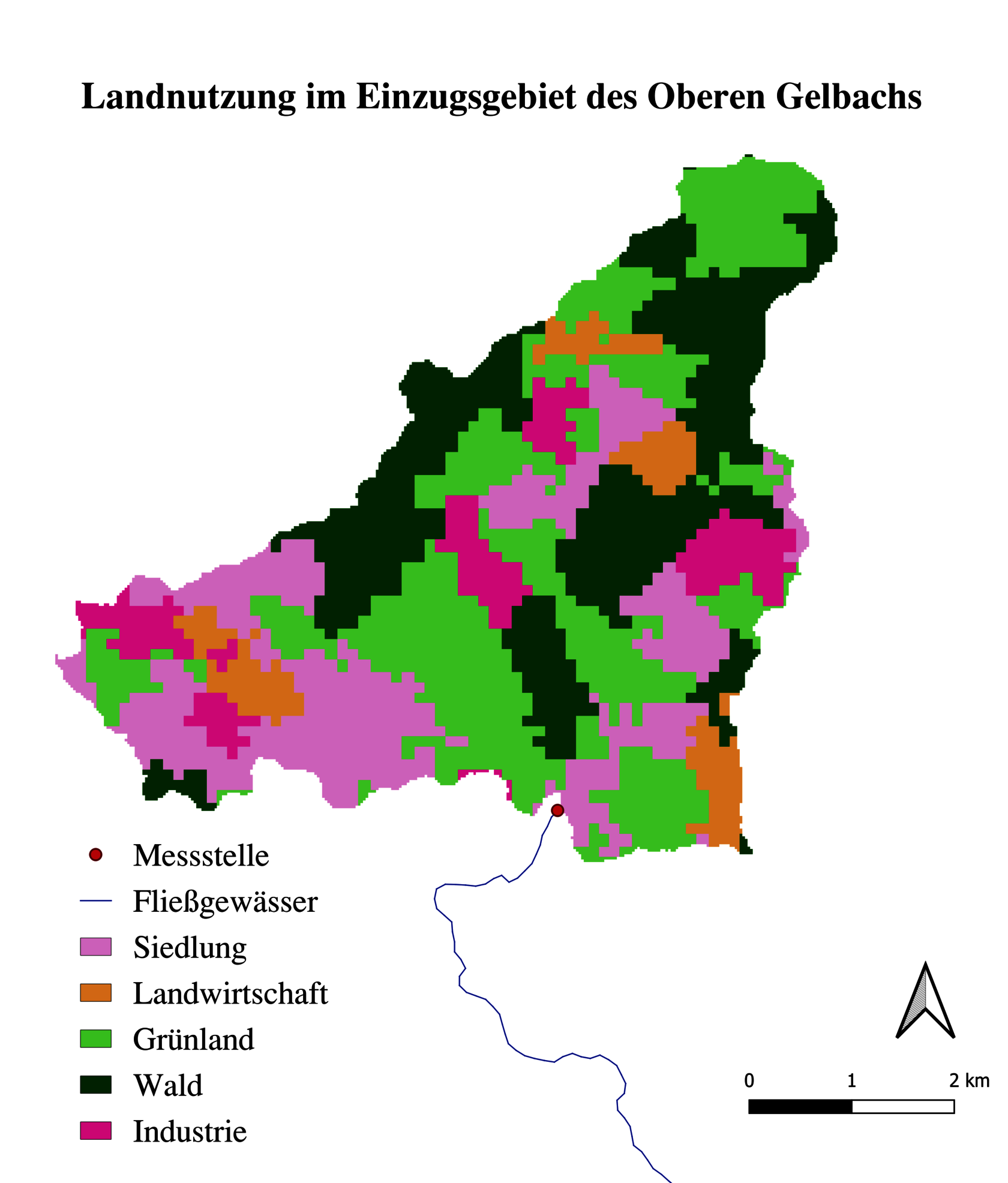
I not only looked at the colmation, i.e. what we measured with the multi-parameter approach, but I also looked at the catchment areas of the watercourses and examined them for different "land types". The point in the river where we measured is in one area and then I looked at geodata from NASA and various environmental agencies: What land use is there? How much settlement is there, how much forest, how much agricultural land or meadows? Then I evaluated this statistically and carried out a correlation analysis using colmation parameters: How high is the correlation between the proportion of forest and, for example, dissolved oxygen? I then did this for all factors.
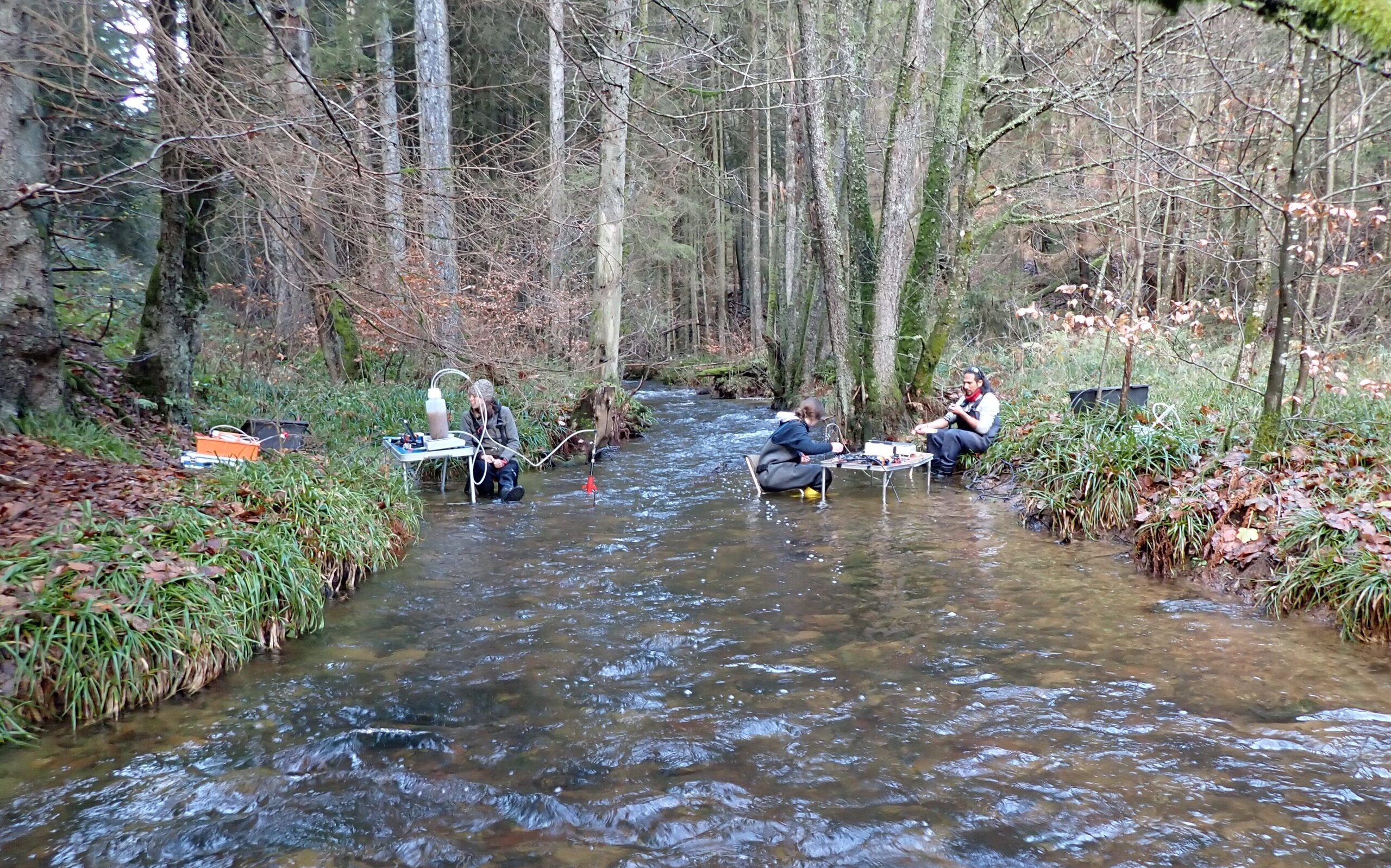
You took great photos of desks in the river – what exactly did you measure there?
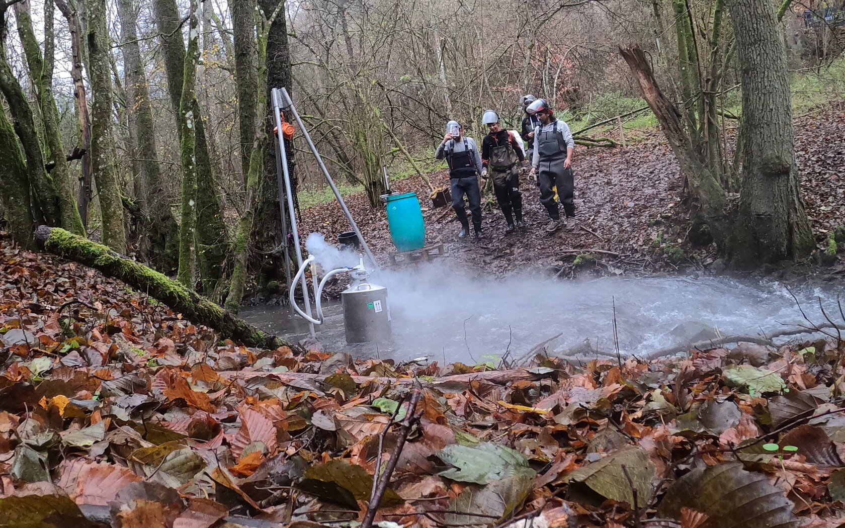
IN: The aim of this project, which is the subject of my bachelor's thesis, is to develop an approach that can be used to make colmation measurable, or to be more precise: there is already an approach from the University of Stuttgart and this project wants to define reference values. So we say: Okay, a body of water of this type – if it is in its natural state – should be colmatized to this extent. To measure colmation, you have to look at several factors. So on the one hand, we looked at the sediment distribution. To do this, we took freeze core samples. We drove a pipe into the bottom of the water and then filled it with liquid nitrogen so that the sediments were frozen. Then we pulled out this frozen sample. The reason we froze it was to get the natural composition of the sediments. If you just took a shovel and dug, it would be distorted.

What is the result of your information work?
IN: The clearest result is actually that a high proportion of settlements is an indicator of high colmation and a high proportion of forest is an indicator of low colmation. It was less clear in the case of agricultural land. I then looked at the reasons for this and it is sometimes the case that, for example, a catchment area with a high proportion of agricultural land also has a high proportion of forest. Then you can consider how this might balance out again.
How can the connection between settlement and colmation be explained in concrete terms?
IN: On the one hand, it has to do with the sealing of the soil. If there is heavy rainfall, then all the dust from the roads is carried into the waters, but there are also sewage treatment plants near settlements, for example, and during heavy rainfall some of the water from there is also disposed of in the waters with fine sediment particles. In forests, the sediments tend to be held in place by the vegetation and are not flushed out as easily as in a dug-up field where the sediments are exposed.
What does this mean for the environment? Colmation can't be good, because then the surface water can't get directly into the groundwater ...
IN: The bigger problem with colmation is the impact on the fish and organisms in the water. In other words, small organisms that actually live in the bed, have to bury themselves in it and feed on biofilms. They need the oxygen in the bed, which is then not there. The reason for this information work was actually also that there is this so-called European Water Framework Directive. It prescribes that all bodies of water must be brought to a good ecological status by 2027. Many measures are also being taken to implement this - watercourse strips are being renaturalized, etc., but it is often observed that although all this information work and money is put in, the ecological status often does not necessarily improve in the end. There is a suspicion that colmation is responsible for this. At the moment, however, colmation is not yet included in the determination of the ecological status and for this you would need these reference values, which are to be determined in the project.
Was there anything that totally surprised you or that you would like to continue researching because it appealed to you?
IN: Basically, this type of information work appealed to me, i.e. going out into the field, recording measured values and then analyzing them. I found it somewhat surprising how much information work is involved in such a research project.
We were on the road with a team of four people. I wrote my information work at the VAW, the Laboratory of Hydraulic Engineering at the HKA, where I was joined by a doctoral student, a master's student and a student assistant, and there were several measurement campaigns. We also did our screenings at the Laboratory of Hydraulic Engineering, for example. We set off quite early every day and had to take all our equipment with us. It was exhausting, quite physical information work. You were totally exhausted in the evening, but it was nice to just be out for two weeks and spend the whole day somewhere in the forest.
What's next for you now?
IN: I'm currently doing information work in a café and taking time to find my bearings, for example doing various internships in the construction sector or traveling. I'm still not quite sure what the next step will be for me and perhaps I could imagine doing something completely different again.
With your excellent degree, we are not worried about your future and wish you all the best. Stay curious and thank you very much for the interview!


